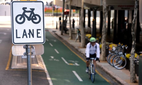
Jacquelyn Hayward Gulati, a Toronto-based cyclist commuter, is considering whether to cycle through the coming winter. It is “only” -5C, she says, but temperatures can plummet to -25C and snow ploughs clear the roads for months.
This winter, however, she is running out of excuses. For the first time, 49km of Toronto’s busiest bike lanes will be classified as “winter priority”, to be ploughed and salted. This is in part due to data collected by the Toronto Cycling App, a tool launched in May 2014, developed by tech company Brisk Synergies for the city, to inform development of the cycling network. As the city’s manager of cycling infrastructure and programmes, Gulati played an integral part.
Popular cycling apps, including MapMyRide, Strava, Runtastic and Runkeeper, are now believed to have combined users in the tens of millions worldwide. In 2013, Oregon’s department of transportation hit upon the idea of using this cycling data to understand how and where people used bikes around the city. It teamed up with Strava, inspiring the company to launch Strava Metro in 2014 to allow other cities to do the same.
Using app data for safer cycling
Brian Riordan, manager of Strava Metro, believes the data – which is collected anonymously to collate a “heat map” of cyclists’ routes, journey durations and frequency – is “incredibly useful for urban planners”.
“In London last year, we tracked 5m trips and 4m of these are commutes. You can see where cyclists are avoiding – possibly despite your best efforts to improve infrastructure – or what is overused. You can quickly locate areas in a network that can be improved or connected.”
Strava Metro is now working with more than 70 urban authorities, predominantly in Australia, the UK and North America. Toronto, however, is not one of them. Gulati and her team built a bespoke app to collect data from scratch. The Toronto Cycling App tracked around 4,000 users and 90,000 trips from May 2014 to July 2015. The data is still being analysed, but Gulati says it has so far uncovered bottlenecks, with the need for safety improvements. The data also includes demographic information, so Gulati will have a better sense of the type of trips or roads people are using.
Gulati admits that a lot of data collected simply confirmed suspicions, but it also revealed a lot more people were using unmarked residential roads than they had known. “We were able to find where cyclists were going the wrong way down one-way streets – so now we can look at increasing the number of contraflow bike lanes,” she explains.
Glasgow also launched its own Glasgow Cycling app a year ago to inform its cycling infrastructure planning. A spokesman for Glasgow city council confirms that it was downloaded by 1,211 users and mapped 1,393 routes, covering 9,138km. Heat maps of routes have uncovered popular and unpopular routes, plus previously unmarked shortcuts.
Strava is disparaging of cities making their own apps. “In all cases that we have seen city-based apps built and used, there has been very limited adoption of the app [and they] tend to be buggy and difficult to use,” Riordan says. “Making a good, high-quality app requires constant improvement and marketing. Both of which are often beyond the realms of cities.”
Gulati, however, believes that the average Strava user is generally a more competitive cyclist, and that city-built apps can capture data from more typical cyclists. . For example, Anthony Lau, bicycle parking entrepreneur and organiser of IBikeLondon monthly rides, says he’s used many popular cycling apps to track his fitness, average speed and power, and agrees that his app data may not be indicative of the average bike lane user.
Privacy concerns
The use of app data has also raised privacy concerns. Strava, for example, has been linked with stories of bike thieves accessing origin and destination data to discover users’ addresses.
Riordan responds that “Strava Metro does not show a user’s home location or any way to locate an athlete… [Plus] there is an easy-to-find toggle for the Strava population to opt-out of Metro, which at this point only 0.00002% of the Strava population has chosen. They want their data to be used for good, to help keep their friends, neighbours and even total strangers safe [by informing city planning].”
Toronto’s app also addresses the issue by only beginning to record data a few minutes after the start of a trip, while questions about demographic groups and income brackets are also optional.
There are other potential uses for crowd-sourced app data. The CleanSpace app, for example, offers an air pollution sensor that connects to a phone’s Bluetooth to gather air quality data street by street, in real time. While CleanSpace hasn’t yet formally teamed up with any city authorities, it could be used to feed into public data sets.
However, the result of how app data changes the design of urban cycling infrastructure is unlikely to be radically new. As Lau says, “the future was here 40 years ago: it’s the Dutch way”. Which is, in a nutshell, “safe, properly segregated, bike lanes”.
Cities already know they need to build safe, segregated cycling routes, but app data could provide the evidence that helps it finally happen.

Comments (…)
Sign in or create your Guardian account to join the discussion